Geographic Information Systems (GIS) have become an essential tool for organizations, governments, and businesses worldwide. They offer a powerful means to visualize, analyze, and interpret data related to specific geographic areas. While GIS provides numerous advantages, the main advantage lies in its ability to enhance decision-making through spatial data analysis, providing valuable insights that would otherwise be impossible to obtain.
What Is GIS and How Does It Work?
GIS, or Geographic Information System, is a computer-based tool that allows users to collect, store, analyze, and display spatial or geographical data. This system enables organizations to interpret location-based data in ways that are visually intuitive and analytically rigorous. In simple terms, GIS lets us see patterns, relationships, and trends in data that relate to specific locations.
Key Components of GIS
There are four main components that make up a GIS:
- Hardware: The physical tools needed to run GIS, such as computers, servers, and GPS devices.
- Software: The applications and programs that allow data input, management, analysis, and display. Popular GIS software includes ArcGIS, QGIS, and MapInfo.
- Data: The core of any GIS system. Data can be spatial (geographically referenced) or attribute-based (non-spatial data that describe the features of the spatial data).
- People: GIS specialists, analysts, and users who interact with the system to process and analyze the data.
How GIS Works
GIS operates by integrating spatial data (data that has a location) with attribute data (additional information about that location). For example, in a map showing the locations of hospitals, spatial data would pinpoint where each hospital is, while attribute data might include information about the hospital’s capacity, facilities, and services.
The workflow of GIS typically follows these steps:
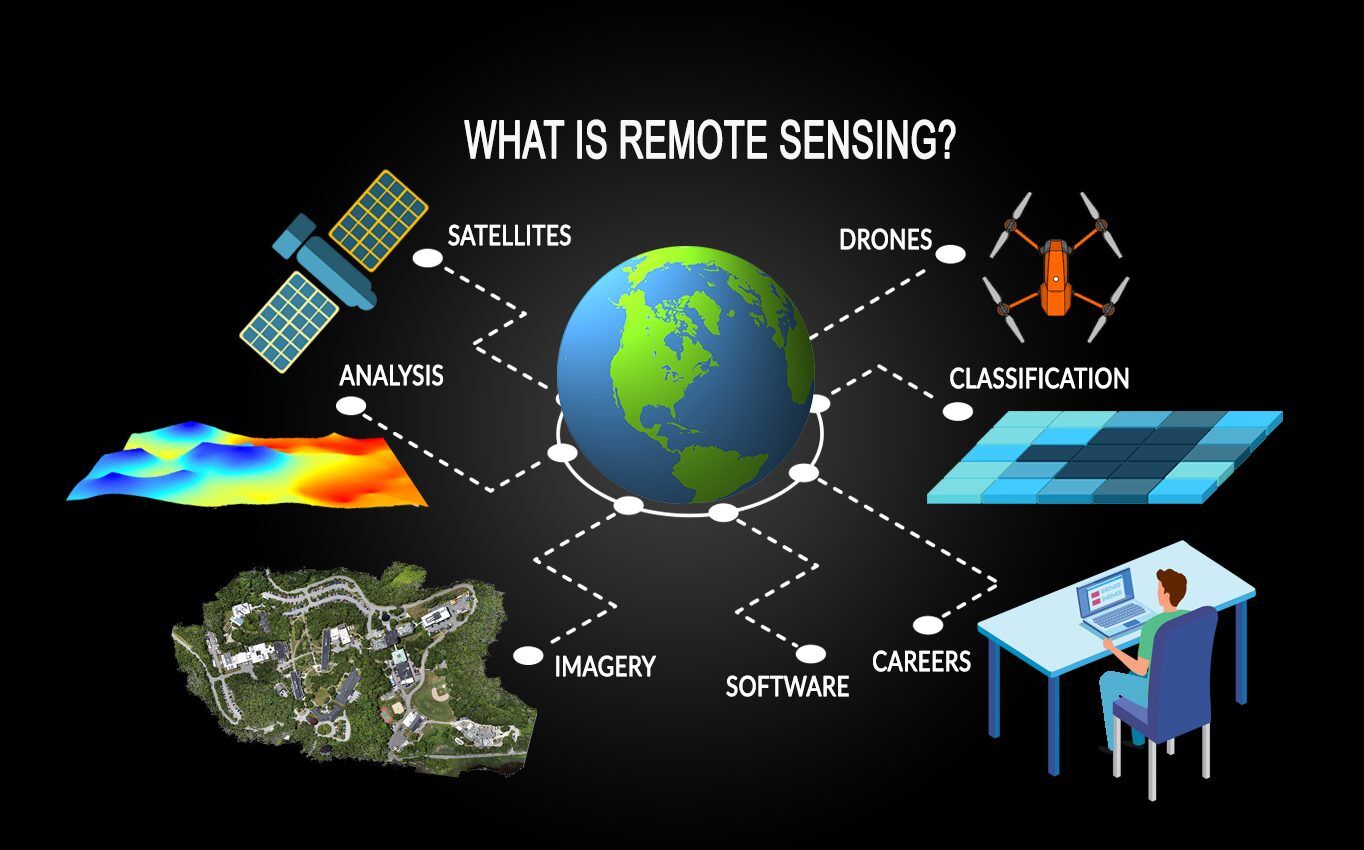
- Data Collection: GIS gathers geographical data from a variety of sources, such as satellite imagery, sensors, and GPS.
- Data Management: The system stores the collected data in a database, where it can be accessed, modified, and analyzed.
- Analysis: GIS software allows users to analyze spatial relationships between different data sets, identifying patterns and insights.
- Visualization: One of the most critical features of GIS is its ability to create maps and visual representations of data. This makes it easier for decision-makers to understand complex geographic relationships.
- Output and Reporting: Results from GIS analysis can be presented in reports, charts, and maps that are easy to interpret.
Real-Life Example
Imagine a city planning department using GIS to analyze traffic patterns. The spatial data might show the location of roads, intersections, and traffic signals, while the attribute data provides details like traffic flow rates, accident hotspots, and vehicle types. With this information, city planners can make informed decisions about where to build new roads or place traffic signals to improve safety and reduce congestion.

The Main Advantage of GIS
At the heart of GIS’s wide-ranging capabilities is its unparalleled ability to enhance decision-making by integrating and analyzing spatial data. This feature makes GIS indispensable in sectors that require complex geographic analyses, such as urban planning, environmental conservation, and business logistics. But what exactly makes decision-making through GIS so powerful, and how does it provide organizations with a competitive edge?
Enhanced Decision-Making Through GIS
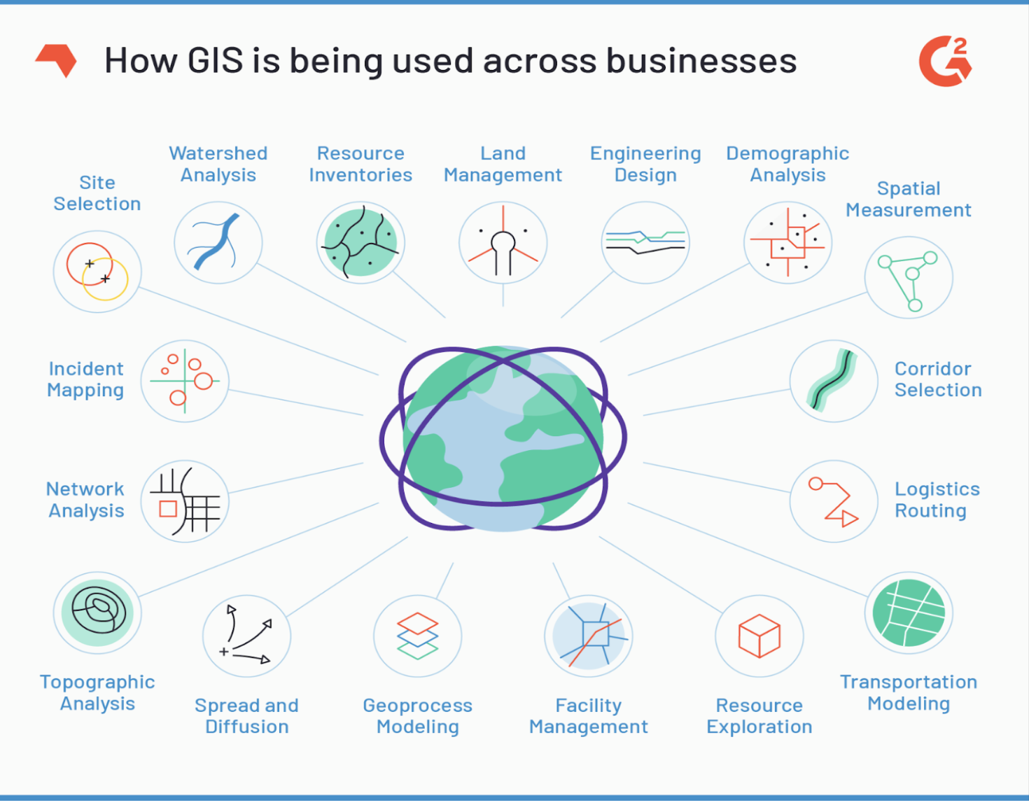
The primary advantage of GIS is that it enables better and faster decision-making by providing a comprehensive picture of the spatial relationships in the data. Whether it’s understanding the geographic distribution of natural resources, optimizing routes for delivery services, or planning disaster responses, GIS offers invaluable insights that traditional data analysis methods cannot achieve.
1. Visualization of Complex Data
GIS turns complicated datasets into interactive, visual maps, allowing users to easily interpret patterns and trends that might not be immediately obvious in spreadsheets or reports. For instance, an environmental agency might use GIS to display layers of data showing land use, water resources, and wildlife habitats, helping them make more informed decisions on conservation strategies.
2. Spatial Analysis for Predictive Insights
Through spatial analysis, GIS allows users to predict future events and trends by examining historical and current data. In real estate, for example, GIS can help investors and developers predict urban growth by analyzing trends in land use, population density, and infrastructure development. This predictive power can lead to smarter investment decisions.
3. Integrating Data from Multiple Sources
GIS can aggregate and analyze data from various sources, such as satellite images, census data, GPS, and even social media. This integration provides a holistic view of the area or issue being analyzed, enabling more comprehensive decision-making. A retail business, for example, might use GIS to combine demographic data, customer locations, and competitor locations to decide where to open a new store.
Real-Life Case Study: GIS in Urban Planning
Case Study: The city of Portland, Oregon, is a great example of how GIS can enhance decision-making in urban planning. By using GIS, the city was able to visualize transportation patterns, identify under-served areas, and plan new public transport routes more efficiently. The city combined data from traffic sensors, GPS units on public buses, and demographic data to optimize its transport network, leading to cost savings and improved public services.
4. Enhanced Resource Management
For industries such as agriculture, forestry, and natural resource management, GIS plays a crucial role in efficient resource allocation. Farmers, for example, use GIS to analyze soil health, water availability, and crop performance to make informed decisions about irrigation, planting schedules, and fertilizer use. This not only increases crop yield but also reduces resource wastage.
5. Timely Responses to Emergencies
GIS is often used in emergency response and disaster management. It can provide real-time data on natural disasters such as floods, earthquakes, and hurricanes, enabling authorities to deploy resources where they are needed most. For example, during the 2010 Haiti earthquake, GIS was used to map areas affected by the disaster, guiding relief efforts and ensuring aid reached the most critical areas quickly.
A Tool for the Modern World
The main advantage of GIS is its ability to enhance decision-making by offering detailed insights into geographic data. Through visualization, data integration, and spatial analysis, GIS helps organizations make better, faster, and more informed decisions. This not only leads to cost savings and improved efficiency but also enables organizations to respond quickly to emergencies, manage resources effectively, and anticipate future challenges.

Other Key Advantages of GIS
While enhanced decision-making is the primary advantage of GIS, it offers several other critical benefits that make it a versatile and powerful tool across industries. From improving efficiency in data management to enabling cost savings and better communication, these advantages contribute to why GIS has become an indispensable part of modern operations.
Improved Efficiency in Data Management
One of the significant strengths of GIS lies in its ability to handle vast amounts of spatial and attribute data. Unlike traditional methods of data storage, GIS can organize and maintain large datasets in a structured, easily accessible manner.
1. Centralized Data Storage
GIS serves as a centralized platform where all geographical data can be stored, updated, and accessed in real-time. This eliminates the need for multiple storage systems and ensures that data consistency is maintained. For instance, governments can store demographic data, land use patterns, and zoning regulations in one place, allowing for seamless retrieval and analysis.
2. Data Layering for Advanced Analysis
One of the unique features of GIS is the ability to layer multiple datasets on top of one another, enabling users to analyze the relationship between different variables. For example, an environmental conservationist might layer data on water bodies, forest cover, and endangered species habitats to determine areas in need of protection.
3. Streamlined Data Maintenance
GIS allows for easy updating and maintenance of data. As geographical conditions or infrastructure changes, the GIS database can be quickly updated, ensuring that all users have access to the most current information. This is particularly valuable in fields like urban development, where infrastructure projects evolve rapidly.
Example: Utility Companies
Utility companies benefit significantly from GIS’s efficient data management capabilities. They can store information about pipelines, electrical grids, and maintenance schedules, enabling them to quickly identify and resolve issues, plan expansions, or perform repairs. By having all this data in one system, they save both time and resources.
Precise Mapping and Visualization
GIS is renowned for its ability to create highly detailed and precise maps, which can be used for a wide range of applications, from environmental monitoring to urban planning.
1. Accurate and Detailed Maps
The precision of GIS-generated maps is one of its standout features. These maps can show detailed features such as property boundaries, transportation networks, water sources, and terrain features, all with a high degree of accuracy. This level of detail is crucial for industries that rely on accurate geographic data, such as civil engineering and land surveying.
2. 3D Visualization
GIS doesn’t just offer 2D maps but also allows for 3D visualizations. These 3D models can represent the terrain, building elevations, and even underground infrastructure. Urban planners can use these 3D visualizations to understand how new developments will interact with the existing environment, giving them a realistic view of future projects.
3. Time-Based Mapping
In addition to static maps, GIS can create time-based visualizations that show changes over time. This is particularly useful in environmental studies, where GIS can track deforestation, urban expansion, or the effects of climate change over several decades.
Case Study: Wildlife Conservation
Wildlife conservation agencies often use GIS to create detailed maps of animal habitats and migration patterns. By overlaying satellite data with on-the-ground surveys, they can track changes in habitat size and quality, informing conservation strategies. For instance, GIS helped the U.S. Fish and Wildlife Service monitor the effects of human activities on endangered species such as the Florida panther, leading to better protection efforts.
Cost Savings
GIS is not just a tool for analysis and mapping; it can also provide substantial cost savings for businesses and governments alike. By optimizing routes, improving resource allocation, and preventing costly mistakes, GIS helps organizations save money.
1. Route Optimization for Logistics
Logistics and transportation companies use GIS to plan the most efficient delivery routes, reducing fuel consumption and travel time. By analyzing traffic patterns, road conditions, and delivery locations, GIS can identify the quickest and most cost-effective paths. This translates into significant savings on operational costs, especially for large-scale delivery networks.
2. Resource Allocation
Organizations can use GIS to allocate resources more effectively. For example, a water utility company might use GIS to monitor water usage across different regions, identifying areas where water is wasted or underused. This allows them to allocate resources like water and manpower more efficiently, reducing waste and operational costs.
3. Preventing Expensive Mistakes
GIS can also prevent costly mistakes by providing accurate data for decision-making. For example, in construction and infrastructure projects, using GIS to survey land and analyze topographical data can prevent builders from choosing unsuitable land or encountering unexpected environmental challenges, saving significant amounts of money in the long run.
Example: Fleet Management
A large company managing a fleet of vehicles, such as a public transport provider or delivery service, can use GIS to reduce fuel consumption and maintenance costs by optimizing vehicle routes and schedules. By ensuring that vehicles take the most efficient paths and avoid traffic congestion, they can cut down on both fuel costs and vehicle wear and tear.
Better Communication
In addition to improving decision-making and cost savings, GIS significantly enhances communication within and between organizations. Maps and visual data are far more effective at conveying complex information than reports or spreadsheets.
1. Visual Communication
GIS enables users to present complex data in easy-to-understand visual formats. For example, a city planner could present a visual map of proposed zoning changes to stakeholders, illustrating how different areas would be affected. This type of visual communication helps ensure that everyone involved in a project can understand the implications clearly.
2. Improved Collaboration
GIS systems allow for real-time sharing of data across multiple departments or organizations. This fosters collaboration, as all stakeholders have access to the same up-to-date information, reducing misunderstandings or data discrepancies.
3. Public Communication
GIS is increasingly used to communicate with the general public. Governments and public agencies often use GIS maps to share information about public services, environmental hazards, and infrastructure projects. For example, during the COVID-19 pandemic, GIS was used to create interactive maps showing the spread of the virus, helping the public and health organizations make informed decisions.
Example: Disaster Management
During natural disasters such as hurricanes or earthquakes, emergency response teams use GIS to communicate the locations of affected areas, evacuation routes, and safe zones. These maps can be shared with the public via websites or mobile apps, ensuring that everyone has access to the critical information they need to stay safe.
These additional advantages demonstrate the versatility of GIS and its ability to deliver benefits across a wide range of sectors. Whether improving efficiency, reducing costs, or enhancing communication, GIS plays a key role in modern operations, making it an essential tool for organizations worldwide.

What Industries Benefit the Most from GIS?
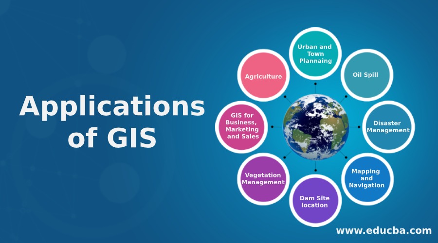
GIS is used across many industries, from government agencies to private businesses, and even non-profits. The spatial analysis and data visualization capabilities of GIS make it especially valuable in industries that depend heavily on geographic data and location-based decision-making. Below are some of the key industries where GIS has the most significant impact.
Environmental Management
One of the most critical applications of GIS is in environmental management. Whether monitoring natural resources, tracking pollution, or planning conservation efforts, GIS allows environmental scientists and agencies to understand the spatial aspects of environmental challenges.
1. Tracking and Monitoring Natural Resources
GIS is widely used in the management of natural resources, such as water, forests, and wildlife. For example, GIS can map forest areas to monitor deforestation or map water resources to track levels of water consumption and pollution. This helps ensure that resources are used sustainably.
2. Pollution Control and Monitoring
Environmental agencies use GIS to track the sources and spread of pollution, whether air, soil, or water pollution. For instance, GIS can map the dispersion of air pollutants in urban areas, allowing for more informed decisions on controlling emissions and improving air quality.
3. Biodiversity and Habitat Conservation
GIS is also crucial in biodiversity conservation, helping to track endangered species and manage their habitats. By overlaying data on species distribution, habitat quality, and human activity, conservationists can create better strategies for preserving biodiversity.
Case Study: Amazon Rainforest Monitoring
The Amazon rainforest is one of the most monitored ecosystems in the world, and GIS plays a significant role in tracking deforestation and habitat loss. Using satellite imagery combined with on-the-ground data, GIS helps environmental organizations monitor changes in forest cover and take action to prevent illegal logging and land use.
Urban Planning and Development
Urban planners rely heavily on GIS for planning infrastructure, zoning, and land use. The ability of GIS to provide detailed spatial data and integrate various types of information makes it a critical tool in modern city planning.
1. Zoning and Land Use Planning
GIS helps urban planners map out zoning areas for residential, commercial, and industrial purposes. This ensures that cities grow in a structured and sustainable way. By analyzing population data, existing infrastructure, and future growth projections, planners can make better decisions about where to build new housing, roads, or parks.
2. Infrastructure Development
GIS is used to plan and manage infrastructure projects, such as roads, bridges, and public utilities. For example, GIS can help planners determine the best routes for new roads by analyzing terrain, existing road networks, and environmental impact.
3. Managing Public Services
Urban planners use GIS to improve public services such as transportation, waste management, and emergency services. For instance, GIS can optimize garbage collection routes or determine the best locations for fire stations to ensure quick response times.
Example: Smart Cities
In the development of smart cities, GIS is used to integrate and manage various urban systems. From transportation to energy distribution, GIS helps planners optimize resources and create more sustainable urban environments. Cities like Singapore and Barcelona are leading examples of smart cities that heavily rely on GIS technology.
Agriculture
The use of GIS in precision agriculture has revolutionized the way farming is done. By providing farmers with detailed spatial data about their fields, GIS enables them to make more informed decisions about crop management, water use, and soil health.
1. Precision Farming
GIS allows farmers to analyze data on soil composition, moisture levels, and crop health, helping them optimize planting schedules, irrigation, and fertilizer use. This not only increases crop yields but also reduces resource wastage.
2. Crop Monitoring
With the help of GIS and remote sensing technologies, farmers can monitor their crops in real-time. This helps them identify issues such as pest infestations or nutrient deficiencies early on, allowing for timely interventions that can save crops.
3. Water Resource Management
Water management is a critical concern for farmers, and GIS helps optimize the use of water in irrigation systems. By analyzing data on water availability, soil moisture, and weather patterns, GIS ensures that water is used efficiently, reducing both costs and environmental impact.
Example: Improving Agricultural Productivity
Farmers in the Midwestern United States use GIS to map their fields, monitor crop health, and optimize irrigation. By doing so, they have increased their crop yields by 20% while reducing water and fertilizer usage, demonstrating how GIS can lead to both economic and environmental benefits.
Disaster Management
In the face of natural disasters, GIS plays a crucial role in planning, responding, and recovering. By providing real-time data and maps of affected areas, GIS helps emergency responders and governments make life-saving decisions.
1. Risk Assessment and Planning
Before a disaster strikes, GIS can be used to assess risk levels in various regions. For example, GIS can map flood-prone areas or seismic activity zones, helping authorities plan for potential disasters and implement mitigation strategies.
2. Real-Time Disaster Response
During a disaster, GIS provides real-time data that is essential for coordinating relief efforts. By mapping affected areas and tracking the movement of rescue teams, GIS ensures that help reaches those in need quickly and efficiently.
3. Post-Disaster Recovery
After a disaster, GIS helps in assessing the damage and planning recovery efforts. By comparing pre-disaster and post-disaster data, authorities can prioritize areas for rebuilding and allocate resources more effectively.
Example: Earthquake Response in Japan
Following the 2011 Tohoku earthquake and tsunami in Japan, GIS was used to map the hardest-hit areas and coordinate relief efforts. The system helped authorities quickly identify which areas needed the most urgent assistance, ensuring that food, water, and medical aid were delivered efficiently.
Healthcare
In the healthcare industry, GIS is increasingly used for tracking diseases, managing healthcare resources, and planning public health interventions.
1. Epidemiology and Disease Tracking
GIS is a valuable tool for tracking the spread of diseases. During outbreaks of diseases like Ebola or COVID-19, GIS was used to map cases, track the spread of infections, and predict hotspots. This helped governments and health organizations allocate resources and implement containment strategies.
2. Healthcare Resource Management
Hospitals and healthcare systems use GIS to optimize the placement of healthcare facilities and services. By analyzing demographic data and healthcare usage patterns, GIS ensures that hospitals, clinics, and emergency services are located in areas where they are most needed.
3. Public Health Campaigns
GIS can also be used to map out public health campaigns, such as vaccination drives. By analyzing population data and healthcare access, GIS helps authorities plan where to set up vaccination centers and how to reach underserved populations.
Example: Malaria Control in Africa
In several African countries, GIS has been used to map the spread of malaria and plan interventions such as the distribution of mosquito nets and the spraying of insecticides. This spatial data has helped health organizations reduce the incidence of malaria in high-risk areas, saving thousands of lives.
These industries demonstrate the widespread utility of GIS. From environmental protection to urban development and healthcare, GIS provides the tools to analyze geographic data, optimize operations, and improve outcomes in diverse sectors.